Mission Planning Simulator
arrow_backTo the overview- Arctic Capabilities
- Communication, IT & Cyber
- Government & Public Authorities
- Innovation & Development
- Land
- Maritime
- National Pavilions
- Startups
- Sub-suppliers
- Test & Measurement
- Tools & Support equipment
- Trade & Industry Associations
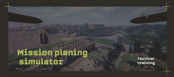
Mission planning tool to train operations before engaging in real life. Images are generated via satellite, hence any location can be simulated.
Real-world geospatial data — orthophoto, LIDAR, and precise coordinates for any location globally
Tactical training
Real drone characteristics with sensor emulation,
air resistance, and full telemetry for authentic training
Comprehensive mission planning with objective customization Multi role simulation
EW simulation




This product can be seen at the exhibition.
This product can be seen at the Exhibition

This product is added by:
PEKKLA
PEKKLA is a Lithuanian defence technology company delivering operationally validated unmanned systems, tactical communications and specialised military training solutions developed in close cooperation with Ukrainian partners and frontline end users. Its founders, management and team members have military backgrounds and bring operational experience gained in Ukraine and across NATO member states.
See profile